
Researchers on a Coastal Resilience Center of Excellence (CRC) project at the University of Rhode Island will have the resources of a major cloud-computing technology to improve the safety of coastal communities.

Dr. Isaac Ginis recently received a Microsoft Azure Research Award, a one-year grant that allows his project team to utilize cloud computing technology to develop models and other three-dimensional visualization products most useful for use by emergency managers, first responders and other professionals.
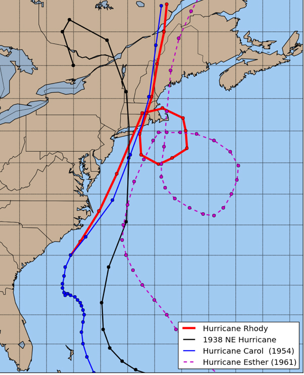
Dr. Ginis’s project, “Modeling the combined coastal and inland hazards from high-impact hypothetical hurricanes,” includes the development of an advanced, multi-modal ensemble system used for realistic computer simulations of hurricane hazards and impacts. Researchers on the project simulate high-impact historical and hypothetical worst-case scenarios by combining multiple hazards elements – including wind, waves and coastal flooding due to storm surge. They are working with Hurricane Rhody, a hypothetical storm that would directly impact Rhode Island.
Microsoft’s Azure is an integrated cloud computing service used to manage applications through a global network of datacenters. The use of Microsoft cloud computing resources will allow development of end-to-end model simulations capable of representing extreme hurricanes with higher visual resolutions and in more specific time increments. Resources will be used to develop models and 3D simulations at all levels of government, and in the private sector.
“By using Microsoft Azure cloud computing, our team will be able to refine the spatial resolutions in ADCIRC and ROMS coastal circulation models to simulate hypothetical, yet plausible high-impact hurricane scenarios,” Dr. Ginis said. “The one-meter resolution will be implemented in critical areas around downtown and the Port of Providence. Utilizing the cores at Microsoft Azure, we will also create an ensemble of models to provide the best possible flood guidance to emergency managers, state and local decision-makers and other users.”
Dr. Ginis and the project team have also been involved with public-sector end-users in regional forecasting. In 2016, Dr. Ginis and colleagues contributed improvements to the National Weather Service’s operational hurricane prediction models. The Geophysical Fluid Dynamics Laboratory and Hurricane Weather Research and Forecasting models adopted Dr. Ginis’s inputs to help track storms in the Northern Hemisphere basins, including the Central Northern Pacific, Western North Pacific and North Indian Ocean. He recently received a Certificate of Appreciation from NOAA for his work.