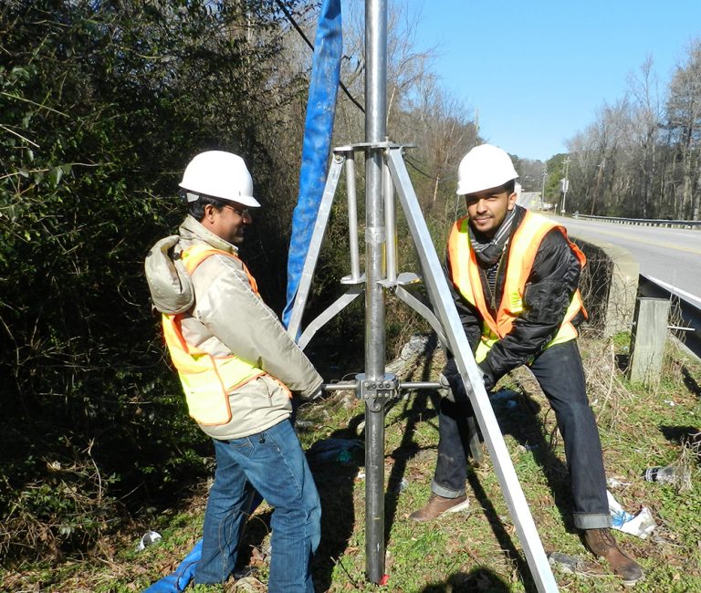
A Coastal Resilience Center of Excellence (CRC) researcher has established a new ASTM International standard using a portable, vertical water-jet probe to measure sand detachment and evaluate erosion related to storms.

The standard describes the components and recommended testing scheme for the “in-situ erosion evaluation probe” (ISEEP), including how to monitor the rate of advancement of the jetting probe and use it to assess the soil erosion parameters, Dr. Mohammed Gabr, Professor of Civil Engineering at North Carolina State University, said.
“The device is portable and does not require the mobilization or use of a power rig to deploy in the field,” Dr. Gabr said. “Because of its capability to provide data with depth, and doing so readily at multiple locations, the use of ISEEP addresses the challenge of defining and assessing spatial distribution of potential scour/erosion rates that might occur after storm events, or in the future with approaching storm events.”
ISEEP produces a velocity and flow-controlled water jet that erodes the soil and allows the probe to self-advance with depth. The penetration depth and time are monitored and the advancement rate is used to assess a soil erosion parameter. This parameter is used for estimating scour magnitude at hydraulic structures, including dams, levees, culverts and bridge foundations.
“The stress level applied by the probe through the jetting process is analogous to flow-induced levels during severe storms,” Dr. Gabr said.
The data from testing can be crucial when assessing the stability of bridges, for example, that serve as lifeline to remote communities, such as the barrier islands of North Carolina or assessing crown erosion in levees if overtopping to occur. The availability of data allows for performing fragility analyses, he said, which are essential for guiding retrofit of critical infrastructure and planning for lifeline utilization under severe storm conditions.

“The device and process were developed to provide the professional community with a tool that can be rapidly deployed for scour evaluation after storm surges or severe flooding events,” he said. “Scour evaluation is an integral element in the process of ensuring the safety of the public and this tool and process provide the means of collecting field data with extended spatial coverage for assessing the stability of several types of critical civil infrastructures that are prone to failure through scour and erosion.”
End users for this standard are companies that perform field testing on geomaterials, state agencies such as departments of transportation, and with training, could include emergency management personal at the state and county level.
The ISEEP device and data reduction procedures in the standard were funded by the Department of Homeland Security (DHS) Science and Technology Directorate through the DHS Coastal Hazards Center of Excellence, led by the University of North Carolina at Chapel Hill. Geotechnical testing companies that perform field testing on geomaterials as well as transportation departments will likely find the standard (soon to be published as D8095) useful.
Dr. Gabr is also a co-PI on a CRC project establishing remote sensing of levee health.
For more information, read about the approach in ASCE Civil Engineering Magazine.
