
Communities across eastern North Carolina have a long road to recovery after experiencing two significant hurricanes in the past three years, but recent reports from the Coastal Resilience Center of Excellence (CRC) point toward several steps that communities can take to make themselves more resilient to future storms.
The Hurricane Matthew Disaster Recovery & Resilience Initiative (HMDRRI), an 18-month effort led by CRC researcher Dr. Gavin Smith, has produced final reports on efforts to aid the recovery process in six eastern North Carolina communities hit by Hurricane Matthew in October 2016. HMDRRI was funded by the State of North Carolina (through disaster-recovery appropriations and through the N.C. Policy Collaboratory at the University of North Carolina at Chapel Hill) and the Department of Homeland Security Science and Technology Directorate, through Office of University Programs and the Flood Apex program.
The project has produced several reports focusing on the unique needs of each of the six focus communities: Princeville, Fair Bluff, Seven Springs, Windsor, Kinston and Lumberton. Reports include Homeplace booklets, which offer proposed design standards for rebuilt or retrofitted homes in each of the six communities, and were developed by North Carolina State University’s Design Lab. Other reports include downtown flood retrofit reports, land suitability analyses and market/financial analyses. Each of these reports can be found by community on the HMDRRI Resources page.
Disaster recovery plans have been developed for Fair Bluff, Seven Springs, Lumberton and Princeville. Recommendations include activities that are not traditionally undertaken by FEMA or state governments following disasters. The plans are intended to support these towns in their recovery from Hurricane Matthew but also large flooding events in general by identifying and addresses local disaster recovery needs, increasing resilience, facilitating collaboration, improving local capacity and drawing together related recovery information in one place.
Additional reports
In addition to recovery plans and Homeplace booklets, additional reports include:
- Downtown flood retrofit studies of Fair Bluff, Windsor and Seven Springs. These propose specific actions that can be taken to reduce future flood losses that respect the historic nature of many of these structures.
- Land suitability analyses, which identify potential relocation areas within each community, for all towns.
- Market and financial analyses for Fair Bluff, Seven Springs and Windsor
- Additional analysis for policies and projects to make communities and neighborhoods more resilient toward future threats.
The towns each faced and continue to face unique issues and are located in four distinct watersheds: Fair Bluff and Lumberton along the Lumber River; Kinston and Seven Springs in the Neuse River watershed; Princeville in the Tar-Pamlico watershed; and Windsor along the Cashie River.
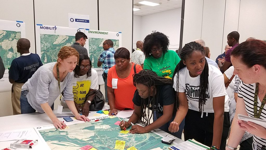
Activities of HMDRRI included a five-day workshop in Princeville, where teams of land use planners, engineers, architects, and landscape architects came together to collaborate with local, state, and federal officials to design a plan for a more flood-resilient future.
For more information, visit the HMDRRI project page.