
On March 31, 2022, the Federal Emergency Management Agency (FEMA) hosted a webinar to announce and showcase updates to their Hazus software, including the new Flood Hazard Import Tool (FHIT). The Department of Homeland Security Coastal Resilience Center of Excellence participated in the event and was represented by Dr. Rick Luettich, who presented an overview of ADCIRC and the ADCIRC Prediction System™ (APS™).
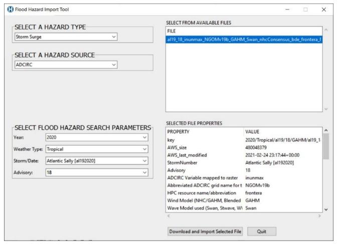
The Hazus FIHT is an open source tool that allows Hazus users to rapidly access and incorporate publicly available flood hazard data for flood analysis. FIHT supports the use of ADCIRC storm surge model output, with future plans to add other flood data sources.
ADCIRC, co-developed by Dr. Luettich, is a system of computer program for predicting circulation, water levels and flooding that has been designed to work in complex coastal areas. ADCIRC is widely used within the academic, governmental and private sectors for forensic flood studies, flood hazard delineation and coastal flood mitigation design. The ADCIRC Prediction System provides timely, event-based storm surge guidance to help pre-storm planning and post storm response.
During the FEMA event, Niyam IT, Inc. Geographic Information System (GIS) Analyst Ashley Hoke gave a general overview of Hazus and the latest updates, while GIS developer Colin Lindeman provided a demonstration on how to access and use the new FIHT tool. Risk Analytics Program Manager Doug Bausch dug into more detail on how to use the data within Hazus.
In his ADCIRC overview, Luettich summarized the model’s features and discussed various coastal hazard applications including retrospective studies, hazard studies under past and future climates, and severe storm forecasts. He also noted how ADCIRC can be incorporated into other areas of practice such as planning and design studies.
Luettich also highlighted that significant recent developments for ADCIRC included integrating precipitation to allow representation of compound flooding and shifting toward the use of cloud-based storage and processing. Working in the cloud limits reliance on institution-based computers, greatly increases on demand capacity and improves security and resource stability.
The Coastal Resilience Center continues to develop and expand its expertise in conducting research and education to enhance the resilience of the nation’s people, infrastructure, economies and the natural environment to the impacts of coastal hazards such as floods and hurricanes, including the effects of future climate trends.