
Hurricane Matthew Recovery – Princeville
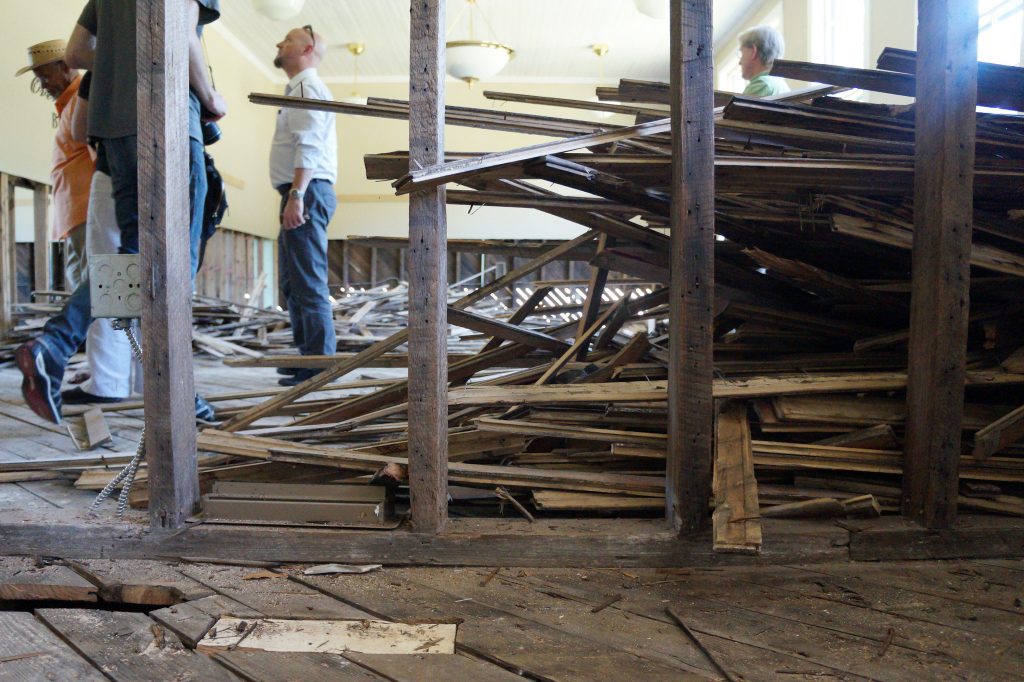
Princeville, N.C., is a town of about 2,200 people, pre-Hurricane Matthew. About 450 homes were destroyed during the hurricane and subsequent flooding, and an estimated 80 percent of the town was underwater.
Founded in 1865 as Freedom Hill, Princeville is the first town founded by freed slaves in the United States. Though surrounded by a levee built in the 1960s, Princeville was affected by two storms less than 20 years apart that overtopped those defenses: Hurricane Floyd in 1999 and Hurricane Matthew in 2016.
Several hundred Princeville residents who attended a multi-day Community Design Workshop, held Aug. 25-29 in neighboring Tarboro, to design a plan for a more flood-resilient future. The event was co-sponsored by the town of Princeville, Edgecombe County, University of North Carolina at Chapel Hill’s (UNC-CH) Coastal Resilience Center of Excellence (CRC), North Carolina State University (NCSU) College of Design, North Carolina Emergency Management and the (N.C.) Governor’s Recovery Office. This five-day workshop brought together teams of land use planners, engineers, architects and landscape architects to collaborate with local, state and federal officials to develop three scenarios for a new 52-acre tract of land that the state intends to buy. The parcel will include houses, businesses, infrastructure, public facilities and community open space in ways that ensure that the new space connects physically, socially, environmentally and economically to historic portions of town. Located outside of the floodplain, the new space would make the town more resilient to future flooding.
Community Design Workshop photos
Reports:
- Recovery Plan
- Homeplace
- Land Suitability Analysis Briefing | Technical Memo
- Princeville Workshop Materials Summary Guide
- Final presentation from Community Design Workshop (9.29.17)
- Princeville Design Workshop Guidebook
Maps:
News:
- Princeville resident guide plans for future of town (Nov. 13, 2017)
- Design teams develop options for Princeville (Aug. 22, 2017)
- Initiative addresses community needs post-Matthew (Aug. 14, 2017) | Photos
- NC students address recovery in Hurricane Matthew-affected communities during DesignWeek (April 11, 2017)
Media coverage:
- UNC center helps historic town rebuild after hurricane by Jay Siebold // Carolina Connection (10.28.17)
- Saving Princeville by The University of North Carolina (10.19.17)
- One year on, Hurricane Matthew is still drowning communities with dilemmas by Tyler Newman // The Seahawk (10.18.17)
- Recovery in North Carolina one year later by Jim Schwab // jimschwab.com (10.14.17)
- Princeville works to save homes and history one year after Hurricane Matthew by Leoneda Inge // WUNC (10.6.17)
- Some N.C. towns struggle to survive a year after Matthew by Jay Price // WUNC (10.4.17)
- Princeville Community Design Workshop (video) by the N.C. Rural Center (10.3.17)
- After two floods, historic African-American town could move to higher ground by Colin Campbell // The News & Observer (9.29.17)
- Landscape architecture professor talks hurricane relief, rebuilding Princeville by Timothy Willard // Technician (9.28.17)
- In this N.C. town, a model for rebuilding is taking shape by Josh Cohen // Next City (9.21.17)
- Hurricane Matthew Infographic (updated) by UNC Office of Research Communications (9.21.17)
- Princeville Community Design Workshop by UNC Research (9.15.17)
- Saving Princeville by NC State News (9.12.17)
- Princeville wraps up revitalization workshop by Emily Gibbs // WNCT (8.29.17)
- Princeville residents get a glimpse of new plans after Hurricane Matthew by Michael Hyland // WNCN (8.29.17)
- 52-acre would add land less flood-prone to Princeville by Adam Owens // WRAL (8.29.17)
- Teams develop plans to make Princeville less vulnerable to flooding by Adam Owens // WRAL (8.29.17)
- Design workshop aims at making plans for North Carolina town by WRAL (8.26.17)
- Princeville partner with design teams to limit flooding in the future by David Hurst // WNCN (8.25.17)
- Princeville kickstarts Hurricane Matthew revitalization by Emily Gibbs // WNCT (8.25.17)
- Design teams gather to plan Princeville’s future by North Carolina Department of Public Safety (8.22.17)
- Princeville steps up recovery efforts after Hurricane Matthew by Rebecca Martinez //WUNC (7.20.17)
- Princeville to host events focused on recovery efforts by Corey Davis // Rocky Mount Telegram (7.20.17)
- First in Future: NCSU Associate Professor of Landscape Architecture and Co-Director for Coastal Dynamics Design Lab Andrew Fox by Institute for Emerging Issues (7.11.17)