
The ADCIRC storm surge model is a major focus of Coastal Resilience Center research projects. Each of the four projects focus on making improvements to the model to allow faster simulations of flooding, both onshore and inland, in time-sensitive situations.
The decreased response time will benefit coastal communities, including emergency management personnel, who will have more time to make decisions before and during the storm event. Read about the four projects below.
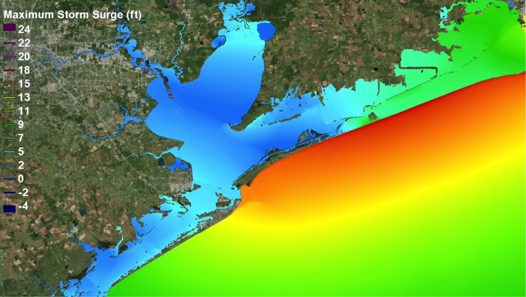
A faster ADCIRC | Improving meshes | Better views of the Gulf | Adding rainfall to the mix
A faster ADCIRC

Dr. Brian Blanton, along with co-Principal Investigator Dr. Rick Luettich (Lead Principal Investigator of the CRC) of the University of North Carolina at Chapel Hill, lead a project titled “A Multi-tiered ADCIRC-based Storm Surge and Wave Prediction System.” The research is leading to a more comprehensive storm surge and wind-wave prediction system for North Carolina and the lower Chesapeake Bay.
The project is improving on ADCIRC in several ways. Using very high-performance computing resources and advanced statistical methods, Dr. Blanton is extending the geographic area covered by the existing ADCIRC-based forecast system. He is also developing a statistical simulation that will accelerate the availability of early guidance for storm surge and wave predictions.
The resulting statistical model, called ADCIRC-Lite, uses pre-computed ADCIRC results and a regression technique (which focuses on the relationship between storm surge levels and hurricane characteristics) to rapidly compute hazard information. That information is supplied to end users such as emergency managers. ADCIRC-Lite will offer an “early” prediction of storm surge threats (within minutes) that will subsequently be followed by the fully dynamic ADCIRC Surge Guidance System output.
Improving meshes

Dr. Casey Dietrich of North Carolina State University, along with Dr. Clint Dawson of the University of Texas at Austin, lead a project called “Improving the Efficiency of Wave and Surge Models via Adaptive Mesh Resolution.” Researchers aim to improve on ADCIRC’s prediction models by reducing the amount of computing time needed for accurate estimates of coastal flooding.
ADCIRC represents a complex coastal region by using triangular “elements” of varying sizes. In the open ocean, these elements may be hundreds or even thousands of meters in size, but they shrink down to tens of meters to represent the detailed water flow through an inlet or over a barrier island.
ADCIRC uses millions of elements to represent all of the possible floodplains in a coastal region, even if many of those floodplains will not be flooded during a given storm. Instead of representing every region that could be flooded, ADCIRC will represent only the regions that will be flooded. This will be done by starting with a coarse model without any floodplains, and then by adding elements as the storm approaches the coastline. At the end of the project, ADCIRC will provide faster predictions without sacrificing accuracy.
Better views of the Gulf

Dr. Scott Hagen of Louisiana State University and co-Principal Investigator Dr. Stephen Medeiros from the University of Central Florida are working on a research project titled, “Development of an Optimized Hurricane Storm Surge–Wave Model for the Northern Gulf of Mexico for use with the ADCIRC Surge Guidance System.” The researchers aim to improve the efficiency of ADCIRC Surge Guidance System (ASGS) through model enhancements as well as expanding the coverage of the ASGS to incorporate the coastal flood plains of Alabama and the Florida panhandle.
ADCIRC runs on a static mesh system, which digitally recreates natural geographical features. While a research-oriented mesh provides an effective representation of the coastal floodplain, it requires extensive supercomputing power. Dr. Hagen’s team works to redefine the research-grade meshes for the northern Gulf of Mexico to enable real-time forecasting capability. The redefinition is done through several methods, such as identifying active floodplains and removing unnecessary elements from the computation. They also plan to improve the model’s efficiency by reducing the number of computational points for high-elevation natural features and enforcing stricter criteria for including vertical features (which take more time to generate) in the model.
This project includes testing novel terrain analysis techniques, such as using a LIDAR-based system to determine the “roughness” of a particular surface (how often the terrain changes) at the regional scale. This method will significantly reduce the calculation time, down to 1-2 hours from an original timeframe of roughly 4.5 hours. This allows for reasonable real-time forecasts as soon as meteorological predictions are made.
Adding rainfall to the mix

Dr. Don Resio from the University of North Florida, along with co-Principal Investigator Tom Richardson of Jackson State University, are working on a project titled “The Incorporation of Rainfall into Hazard Estimates for Improved Coastal Resiliency.” Researchers aim to incorporate rainfall into the ADCIRC storm surge model system to create more comprehensive prediction tool that reflects all sources of flooding during coastal storm events.
While the ADCIRC system is highly accurate in projecting the location of coastal flooding, ADCIRC currently does not include the effects of rainfall or river discharge in its predictions in most areas. In order to improve ADCIRC, as well as to understand the degree of flooding from inland waterways and the location and scale of rainfall during a tropical storm, Dr. Resio and his team will develop a model that includes rainfall-runoff effects for Federal Emergency Management Agency-Joint Probability Method studies, and evaluate the potential impacts of adding these effects into estimates of flooding. The Joint Probability Method is a widely used approach FEMA utilizes for coastal flood estimation.
The project will also include incorporating the impacts of major tributaries into the ADCIRC model, including rainfall effects during a surge event. With this addition, there will be a more comprehensive prediction of the damage a storm could have on a coastal community from a combined flooding of inland waterways and storms surge along the coast.
Initial investigations into rainfall patterns and their impacts on inland flooding have shown that three factors are particularly important in determining the contribution of rainfall and runoff to overall flooding: 1) storm size (large storms produce significantly more rainfall); 2) storm forward speed (slower-moving or stalled storms produce the highest relative impacts); and 3) storm track (storms that track along the coast or slightly inland producing significantly more rainfall than storms that remain offshore).